
Wayfenn Photo Geotag
Not claimedYour photographs have a time
By Gobling Company · Photo and videoWhy we expect it: The description is careful and clear, explaining exactly how timestamps, gaps and original files are handled.


About
Your photographs have a time. Your GPX has a path. Wayfenn brings them together.
One purchase includes local photo matching, clock correction, manual overrides and real GPS-tagged JPEG exports on iPhone and iPad.
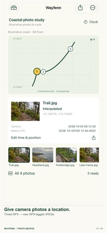
OPEN YOUR OWN FILES Bring a timed GPX and camera JPEGs from Files. Sources are copied into a local trip; the original files are never edited. A coordinate plot shows the timed track and linked photo markers. Select a photo to inspect its camera timestamp, interpreted UTC, location and matching status. iPad keeps the photo list beside the broad route workspace.
GET THE CLOCK RIGHT Set the fallback camera timezone in minutes and a signed clock correction in seconds. Embedded EXIF timezone offsets take priority. Use an explicit per-photo UTC override when a camera timestamp is missing or wrong. Matching time does not rewrite the JPEG camera capture date.
REVIEW THE GAPS Exact recorded timestamps use that fix. Other times interpolate between neighbouring fixes within one segment using the shortest longitude difference. You choose the maximum allowed gap, from 1 to 3600 seconds. Photos outside the track, across segment boundaries or within larger gaps stay unmatched. Untimed GPX points are ignored. Positions estimate where the logger was, not the subject's verified location or GPS accuracy.
KEEP CONTROL Preserve existing GPS by default, choose to overwrite resolved positions, or enter a manual WGS84 coordinate. Include or exclude individual photographs. Rename, duplicate or delete trips, keep notes, rename or remove retained photos and reopen decisions later. First launch is empty; an optional study uses original generated illustrative photos and a synthetic coastal route.
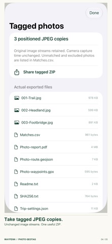
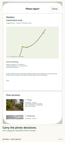
TAKE REAL FILES Export a ZIP containing selected, positioned JPEG copies, an all-photo decision CSV, photo-waypoint GPX, route-and-photo GeoJSON, photographic PDF report, settings JSON, readme and SHA256 manifest. Each GPS write uses Apple's ImageIO metadata copying and checks that the JPEG compressed image stream is unchanged. GPS UTC records matching time; capture dates stay unchanged. Existing GPS copies are untouched when preserved. No altitude, speed or accuracy is inferred.
Preview the actual PDF and share named files using the system sheet. Unmatched and excluded photographs are omitted from the tagged folder and explicitly listed in the CSV. Standard metadata is merged; preservation of every proprietary MakerNote or unknown third-party field is not guaranteed. Original photos and the imported GPX are retained separately. Settings JSON describes decisions, not a restorable backup. Save exports and back up originals before deleting a trip or app. Shared files contain precise locations.
SUPPORTED SCOPE JPEG only: single still up to 40 megapixels and 50 MiB. GPX 1.0/1.1 UTF-8 timed track points, up to 2 MiB and 50,000 points, with strictly increasing timestamps across segments. Routes and standalone waypoints are not matched. Keep 100 photos per trip, 20 trips, 250 MiB of sources per trip and 1 GiB in the library.
No RAW, HEIC or PNG editing, camera capture, GPS recording, basemap, geocoding, navigation, Photos-library changes or cloud sync. No account, subscription, advertising, analytics, tracking or developer-server upload. Everything runs locally until you choose to share.
People rate it
Sign in to rate this app. Honest is what counts.
No ratings yet. Tried it? Be the first to rate it.