
Live Earth Map Street View
Inget anspråk gjortLive Earth Map Street View is a navigation and location exploration application designed…
Av SOFTAXES TECHNOLOGY ( PRIVATE ) LIMITED · Resor




Kort sagt
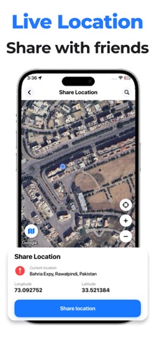
Live Earth Map Street View is a travel app that combines GPS navigation, live traffic, Street View, satellite maps, nearby places, weather forecasts, and a parking finder in one interface. It is aimed at drivers, commuters, and tourists who want these tools without switching between separate apps. One notable feature is the parking finder, which can save a spot, guide users back to it, and share parking details.
Sammanfattning från Debuts, baserad på appsidan i App Store.Om appen
Live Earth Map Street View is a navigation and location exploration application designed for travelers, daily commuters, drivers, tourists, and anyone who needs convenient access to maps and location-based information.
The app helps users navigate to destinations, explore places, check traffic conditions, discover nearby points of interest, review weather forecasts, and locate parking. It brings multiple useful travel and navigation tools together in one application, reducing the need to switch between separate apps for everyday journeys.
Main Features:
GPS Navigation: Users can search for destinations, access route guidance, and share routes with others to make trip planning easier.
Live Traffic: Users can view available traffic information to help plan their journeys and make informed route decisions.
Speedometer: Users can check their current speed while traveling.
Compass: Users can identify directions and understand their orientation while navigating or exploring unfamiliar locations.
Street View: Users can open Google Maps Street View to explore available street-level imagery of their current location and better understand the surrounding area.
Satellite Map: Users can explore locations through satellite imagery for a different visual perspective of geographical areas.
Nearby Places: Users can discover nearby points of interest and useful places around their current location.
Weather Forecast: Users can check available weather information to help plan trips and outdoor activities.
Parking Finder: Users can find nearby parking locations, save a parking spot, navigate back to a saved location, share parking details, and delete saved parking locations when they are no longer needed.
Så betygsätter folk den
Logga in för att betygsätta appen. Det ärliga betyget räknas.
Inga betyg ännu. Har du provat appen? Ge det första betyget.
Fler appar i kategorin Resor
Veckans bästa nya appar i kategorin Resor ItineroKeep your itinerary and travel details together before, during and after your trip
 HissiFür alle, die auf Aufzüge angewiesen sind: Rollstuhlfahrer:innen, Eltern mit…
 LoungeIQ: Airport LoungesLoungeIQ tells you which airport lounges you can actually get into
 FjellFjell answers one question: how long would it take to walk there?
 Leave the ResortLeave the Resort is the travel app that stops you getting ripped off
 Schengen Days: 90/180 PlannerJust enter your entry and exit dates