
FlyGlyph: Sky Art for Pilots
Ikke gjort krav påFlyGlyph turns a word, a name or a heart into a flight plan your autopilot can fly, or…
Af Lenny Tropiano · RejserDerfor forventer vi det: Clever idea with careful airspace checks and thorough descriptions makes it a promising debut for pilots.



Kort fortalt
FlyGlyph: Sky Art for Pilots turns a word, name, or symbol into a flight plan that an autopilot can fly, and the GPS track can appear as art on FlightAware or Flightradar24. It is aimed at pilots who want to draw shapes or lettering in the sky. Its standout feature is an airspace check against FAA Class B, C, D and special-use areas, with alerts by airspace name.
Resumé fra Debuts, baseret på app-siden i App Store.Om appen
FlyGlyph turns a word, a name or a heart into a flight plan your autopilot can fly, or you can hand fly. On FlightAware and Flightradar24, your GPS track writes it across the sky for everyone to see.
TYPE IT • Bubble, line or cursive lettering, or a heart or star in one tap • Letters sized for your aircraft: cruise speed, autopilot bank limit and a wind allowance set every turn • Symbols: 18 shapes in one tap, from a heart, star and crown to an airplane, UFO and lightning bolt • Every plan fits in 100 waypoints, the limit of most modern GA panel GPS navigators • No turn sharper than your autopilot can fly, and no overlapping turns
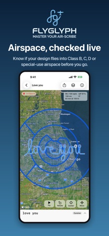
KNOW YOUR AIRSPACE • Checks the predicted track at your planned altitude against FAA Class B, C and D airspace and special-use areas: prohibited, restricted, MOAs, warning and alert areas • Alerts by name, like "In KORD Class B" or "Near KGTU Class D", with floors, ceilings and what each one requires • Airspace outlined on the map and listed on every design in My Designs • Updates live as you move, resize, rotate or change altitude • FAA data refreshed every 28-day cycle; FlyGlyph asks before downloading it
PLACE IT • Start over your home airport or at your location • Jump to where you are, your home airport or any of 12,000+ US airports in one tap • Drag, pinch and twist on satellite imagery or the FAA VFR sectional • Height and width in nautical miles, track length and flight time
PREVIEW IT • Watch a plane fly the whole design at 100× to 1000× before you take off • An A/P score shows how closely an autopilot will follow the shape
GO BIG • Line up 2–3 designs in a folder to spell longer messages, each its own flight plan
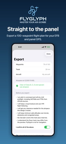
EXPORT IT • Garmin .fpl for ForeFlight and other EFBs, plus GPX, KML and CSV • A pilot-in-command checklist before every export
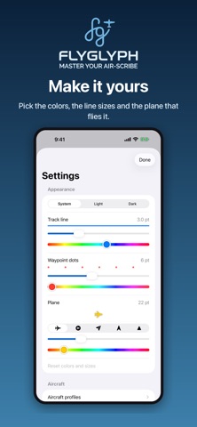
MAKE IT YOURS • Undo and redo, backup and restore, track and plane colors and icons • No account, no ads, no tracking: your designs stay on your device • iPhone, iPad and Apple silicon Mac
PRICING Try everything free for 3 days, then unlock it once for $3.99. No subscription.
FLY SAFE FlyGlyph is a planning and creative tool, not a navigation source. The airspace check covers the United States and does not include TFRs, NOTAMs or whether part-time airspace is active. Check airspace, TFRs, NOTAMs, terrain and fuel with official sources before every flight. The pilot in command is responsible for the safe conduct of the flight.
Brugernes bedømmelse
Log ind for at bedømme appen. Det vigtigste er, at du er ærlig.
Ingen bedømmelser endnu. Har du prøvet den? Giv den første bedømmelse.
Flere apps i kategorien Rejser
De bedste nye apps i kategorien Rejser denne uge HissiFür alle, die auf Aufzüge angewiesen sind: Rollstuhlfahrer:innen, Eltern mit…
 Leave the ResortLeave the Resort is the travel app that stops you getting ripped off
 Schengen Days: 90/180 PlannerJust enter your entry and exit dates
 Trova Treasure HuntsTurn a walk through the city into a treasure hunt
 LeaveTime — When to LeaveLeaveTime answers one question: what time do I need to leave to make my flight?
 MapTogether: Group TravelStop juggling one app for the plan, another for splitting costs, another for photos, and…